Project Description
The Maplehurst Corrections Centre is subject to flooding during a regulatory storm event (Hurricane Hazel) from tributaries to the Sixteen Mile Creek, which puts 38% of the property in a high-risk flood zone, according to provincial standards. The flood risk poses a significant risk to loss of life for staff, inmates, the facility and surrounding properties.
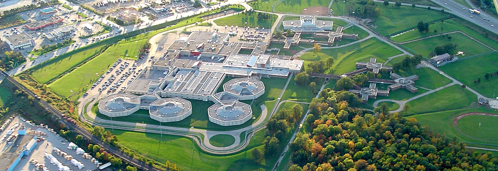
Located on 43 hectares (106 acres) of land at Highway 401 and Regional Road 25 in Milton, the Maplehurst Correctional Centre is a medium and maximum-security facility with 1,500 inmates and 800 staff. It is managed by the Province of Ontario.
Conservation Halton, Infrastructure Ontario (IO), and the Ontario Ministry of the Solicitor General (SOLGEN) are investigating ways to protect the correctional centre from flood events, in order to reduce the risk to life and property. This study is subject to the Class Environmental Assessment for Remedial Flood and Erosion Control Projects, regulated by Conservation Ontario (January 2002, as amended in June 2013), under the Ontario Environmental Assessment Act.
The objectives for the study are to prevent and reduce the effects of flooding and erosion, loss of life and property, as well as economic and environmental impacts. The results of the study will inform plans for remedial actions. The Maplehurst Correctional Centre Flood Mitigation Planning initiative is a multi-year project, to be executed in three phases.
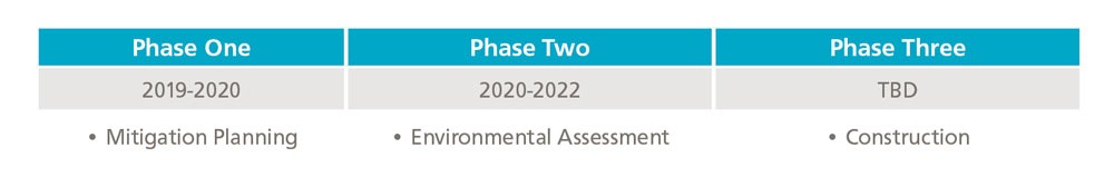
Phase One and Phase Two of the project are led by Conservation Halton and will result in the following:
- Updated flood risk modelling
- Evaluation of possible options and selection of a preferred approach to reduce flood risk
- Recommendations for additional studies required to move the project forward.
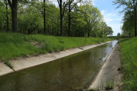
The property has three separate watercourses, totalling 1.2 kilometres, flowing in from north of the site and out through three CN Railway culverts associated with the CN track deck berm. When the correctional facility was expanded in the 1960’s, the province converted two of these creeks into concrete channels (785 metres) and a 200-metre section was buried. During large rain events, the CN Railway culvert capacities cannot pass the volume of upstream floodwaters. As a result, the flood waters create a backwater condition on the property and upstream properties. Eventually, relief of this backwater condition is found through the Regional Road 25, crossing beneath the CN Railway overpass.
Flood risk criteria is defined by three risk factors: depth, velocity and a factor of depth multiplied by velocity, according to the Ministry of Natural Resources and Forestry.
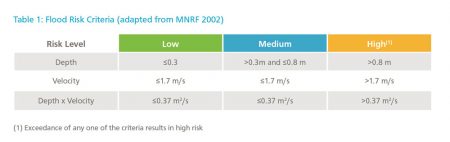
High-risk flood zones do not facilitate safe access of any kind, due to the depth of flood waters and the velocity of the flow in the floodplain. About 38% of the Maplehurst Correctional Centre property is deemed as a high-risk flood zone, including the entire main parking lot and the main building entrance. In the event of a large rainfall, access to and from the facility would be limited to the Vanier Centre for Women building entrance, which is adjoined to Maplehurst.
Riverine flooding may be caused by several mechanisms, including limitations to structure capacity, channel conveyance capacity and backwater conditions. Modelling results demonstrate that the main cause of severe flooding on the property is undersized downstream culverts, located beneath the CN Railway.
Riverine flooding may be caused by several mechanisms, including limitations to structure capacity, channel conveyance capacity and backwater conditions. Modelling results demonstrate that the main cause of severe flooding on the property is undersized downstream culverts, located beneath the CN Railway.
A flood at the Maplehurst Correctional Centre would require a major emergency response, impact the accessibility of major roads, endanger the lives of inmates, staff and other community members, cause damage to the environment, and result in substantial economic impact. This project seeks to enhance public safety by reducing the impacts of flooding at a high-risk provincial facility.
Efforts to address this situation need to be in collaboration with the Canadian National Railway Company, the Region of Halton’s Highway 25 Transportation Corridor Improvements, and the Highway 401 Expansion Project.
This study will enable Conservation Halton to provide expertise and work with partners, including provincial agencies, to prevent the loss of life and property due to flooding.
This project supports and implements initiatives which contribute to the following
- Conservation Halton Strategic Plan
- Ontario’s Flooding Strategy
- Ontario’s Emergency Management and Civil Protection Act
- Ontario’s Provincial Policy Statement
This project is supported by the Province of Ontario and the Government of Canada. The views expressed do not necessarily reflect those of the Province.