Current Lake Ontario Shoreline Flood Status: Normal
Conservation Halton Flood Terminology
The following is the flood and water safety terminology that is used by Conservation Halton, as well as other conservation authorities throughout Ontario, and Ministry of Northern Development, Mines, Natural Resources and Forestry. The terms were developed by a committee of representatives of conservation authorities, Conservation Ontario, the Ministry of Northern Development, Mines, Natural Resources and Forestry and Environment Canada, to ensure alignment with terminology used by other agencies such as the Weather Network.

Normal: Conditions are within normal limits. No flooding is expected.
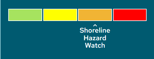
Shoreline Hazard Watch: High water levels and waves along the Lake Ontario Shoreline (within Conservation Halton jurisdiction) that could lead to flooding and erosion caused by a combined water level of above 75.1 m (IGLD 1985) and forecast offshore waves of greater than 2.0m (related to public safety and erosion risks) or a static water level between 75.5m – 75.9m (IGLD 1985).
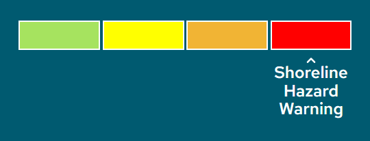
Shoreline Hazard Warning: High water levels and waves along the Lake Ontario Shoreline (within Conservation Halton jurisdiction) that could lead to flooding and erosion caused by a static water level > 75.9m (IGLD 1985).
Summer Safety Message
Be Aware of Urban Flooding Due to Thunderstorms
Conservation Halton is reminding residents of the dangers that exist near rivers, streams, ponds and lakes due to high intensity thunderstorms. Thunderstorms can develop suddenly during the warmer months and are often accompanied by strong winds, hail, lightning and heavy rain. Residents should be aware that flooding can occur very quickly with passing thunderstorms.
River flooding occurs when rivers and streams rise over their banks and spill into the surrounding land. With high intensity summer thunderstorms, watercourses within Conservation Halton’s jurisdiction can receive large amounts of precipitation over a short period of time, causing water levels to rise with little warning. This type of flooding is more common in urban areas.
Summer Safety Tips – River Flooding
- Stay away from riverbanks and avoid recreational activities in watercourses during storm events, especially thunderstorms.
- Do not drive through, stand, or walk in any moving water. Avoid low-lying areas such as road underpasses and walkways.
- Stay informed on storm events such as thunderstorms through local radio, television, mobile, or other public alerting systems.
- If you are instructed by emergency officials to evacuate due to flooding, do so immediately.
- If you are in danger, call 911 immediately.
Flood Forecasting and Operations Program
Conservation Halton provides a flood forecasting and operations program to reduce the risk of property damage and loss of life due to flooding. When flooding is possible or about to occur, Conservation Halton issues flood messages to municipal officials, emergency medical services, police, school boards and media. It is the responsibility of municipal officials to warn local residents.
Conservation Halton is responsible for the maintenance and operation of four major flood control dams (Kelso, Hilton Falls, Scotch Block and Mountsberg) and more than 12 kilometers of flood conveyance channels (Sixteen Mile Creek through Milton, Morrison-Wedgewood diversion in Oakville and the Hager-Rambo diversion in Burlington).
Contacts:
Glenn Farmer
Manager, Flood Forecasting & Operations
Mobile: 647-458-1046
Email: gfarmer@hrca.on.ca
Shelly Datseris
Manager, Communications and Marketing
Mobile: 905-208-0030
sdatseris@hrca.on.ca