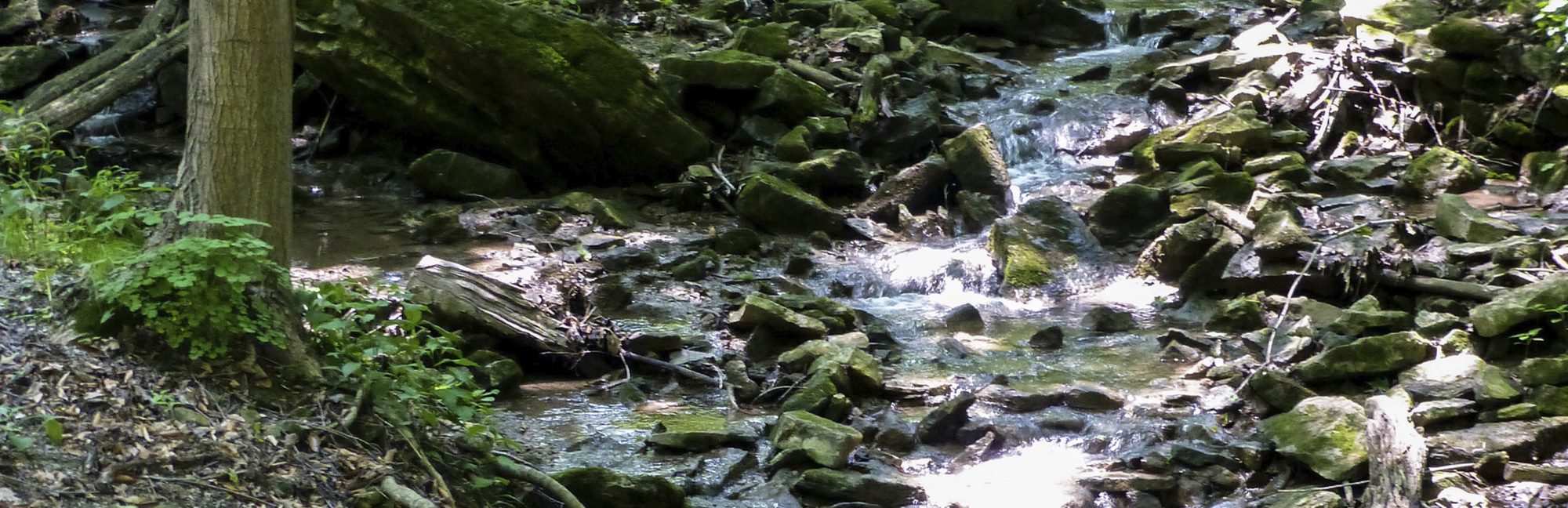
A watershed is an area of land where rain and snowmelt drains into the same body of water, such as a stream, creek, river, or lake. Protecting our watersheds is important because they provide us with multiple environmental, economic, and social benefits.
We depend on the water that flows through our watersheds for drinking, farming, manufacturing, and recreation as well as providing habitat for fish and other wildlife. The creeks, streams, wetlands, forests, valleys and other natural features provide a variety of benefits: they help reduce pollution and contaminates from our sources of drinking water, absorb rainwater during severe weather events to prevent flooding, erosion, and drought hazards, reduce air temperature during heat waves, capture and store carbon to mitigate the impacts of climate change, and support biodiversity in support of healthy ecosystems. Watersheds provide important ecological services for agriculture, forestry, fisheries, aggregate extraction, and other industries, as well as supporting the mental and physical health of the people who live and work in our communities.
Conservation authorities use “integrated watershed management,” which is an approach that acknowledges that resources are connected within a natural system. What happens to one part of these natural system will impact the entire system, and we strive to recognize and understand these relationships. This approach helps us identify priorities and frame our strategic plan, which then guides our watershed programs and services.
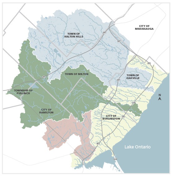
Conservation Halton is responsible for an area of more than 1000 square kilometres. This includes the Grindstone, Bronte and Sixteen Mile Creek watersheds and 18 smaller urban watersheds that enter Lake Ontario, from Grindstone Creek in the west to Joshua’s Creek in the east.
Watershed Areas
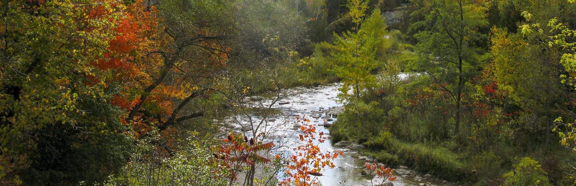
Grindstone Creek begins in a swampy area above the Niagara Escarpment. The creek passes through rural lands in Hamilton and west Halton before winding through the urban neighbourhoods of Waterdown, Aldershot, and Bayview and discharging into Hamilton Harbour. Grindstone Creek drains about 100 square kilometres and provides 14 percent of the water that flows into Hamilton Harbour. A portion of the watershed is within the Carolinian forest, which is a unique ecosystem that supports incredible biodiversity, including species found nowhere else in the world.
Bronte Creek watershed is about 300 square kilometres of mostly rural land that includes parts of Wellington, Hamilton, Milton, Burlington, and Oakville where the creek empties into Lake Ontario. The main branch of Bronte Creek is 48 kilometres long and there are 12 tributaries that feed into the creek. Many people who live and work in the Bronte Creek watershed are dependent on groundwater sources for drinking water and agricultural purposes.

Sixteen Mile Creek watershed is about 360 square kilometres that includes both rural and urban land uses. The creek drains parts of Halton Hills, Milton, Mississauga, and Oakville where it flows into Lake Ontario. There are three water control reservoirs used to manage floods and low flows within the Sixteen Mile Creek watershed.
In addition to the three main watersheds (Grindstone Creek, Bronte Creek, and Sixteen Mile Creek), there are 18 smaller watersheds within Hamilton, Burlington, Oakville and parts of Mississauga. These watersheds tend to be long, narrow areas of land, more rural at the northern reaches, and more urban in the southern areas, where they drain into Lake Ontario. These watersheds offer unique natural features such as the Niagara Escarpment, Carolinian forests and remnants of prairie and oak savannah despite the amount of development within them.
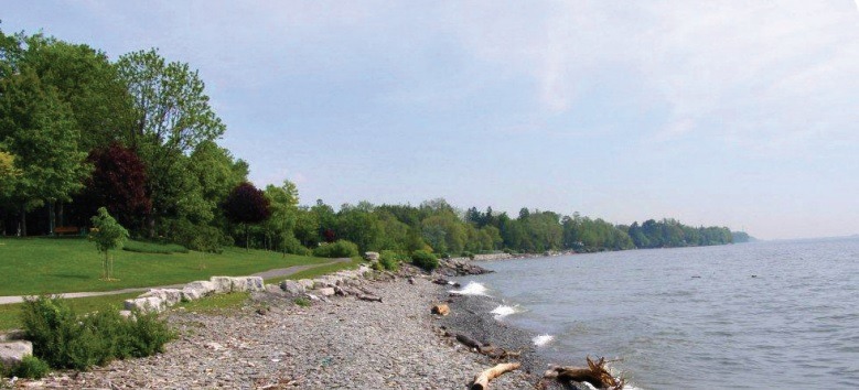
There are about 23 kilometres of Lake Ontario shoreline included in the watersheds that drain into Lake Ontario. The nearshore is where sediments and runoff from the watersheds are mixed, sorted and transported along the shoreline. This zone supports a wide variety of aquatic species and is where biological activity in the lake is the greatest. It also supplies drinking water for and receives treated wastewater from many urban residents living in the watersheds.
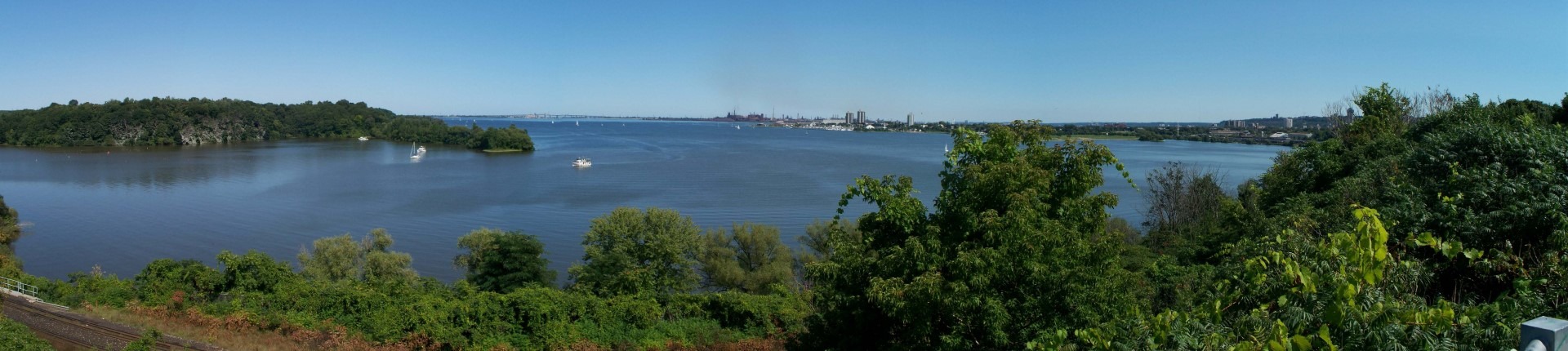 Hamilton Harbour was identified as an Area of Concern under the Great Lakes Water Quality Agreement in 1987 because of extensive environmental degradation. The Hamilton Harbour Remedial Action Plan was prepared and is implemented by a coalition of agencies and community groups to address environmental damage. The goal is to remediate the harbour and remove it as an Area of Concern. Conservation Halton is a member of the coalition and performs secretariat duties for the group. We are proud to be part of this collaboration.
Watershed Management
Natural assets are natural resources, such as forests and wetlands, that deliver services needed for the health, well-being, and long-term sustainability of a community and its residents. In 2019, Conservation Halton, Hamilton, Burlington, and the Royal Botanical Gardens partnered with the Greenbelt Foundation and the Municipal Natural Assets Initiative, to undertake a study in the Grindstone Creek watershed. The purpose of the project was to explore the value of natural assets in addressing natural resource issues. The final report was completed and released in 11月 2022. The study showed that the watershed offers approximately $2 billion in stormwater management services and about $34 million annually in other benefits, including erosion control, carbon storage, and recreation.
For more than 60 years, Conservation Halton has developed watershed management plans, which identify key resource issues and guide the implementation of programs and services to protect life and property from natural hazards. It is important to update these plans to include strategies focused on climate mitigation, adaption, and resilience.
Conservation Halton undertakes a wide range of programs and services for the benefit of watershed residents and the environment. These programs and services are either guided by watershed management plans or by legislation, such as the Conservation Authorities Act and the Clean Water Act, or by municipal and provincial priorities.
Key watershed programs and services include:
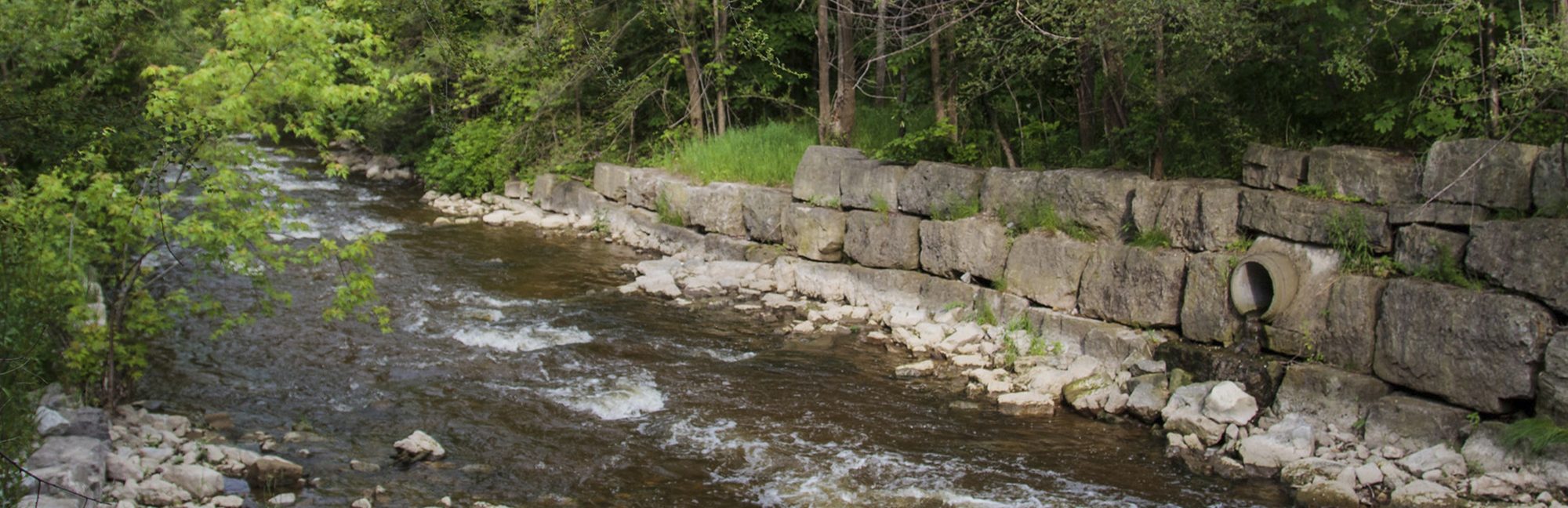
- Flood and erosion hazard management, including flood forecasting and flood warning, as well as operation and maintenance of four dams and three channels to prevent and minimize the impacts of flooding
- Environmental restoration activities on public and private lands, including project management and funding to landowners who want to restore their lands
- Community education programs to help residents understand the benefits and importance of protecting our natural resources
- Administration of regulations to restrict development in valley lands, shorelines, wetlands and other hazard lands
- Administration of the Halton-Hamilton Source Protection Program to protect current and future municipal drinking water sources
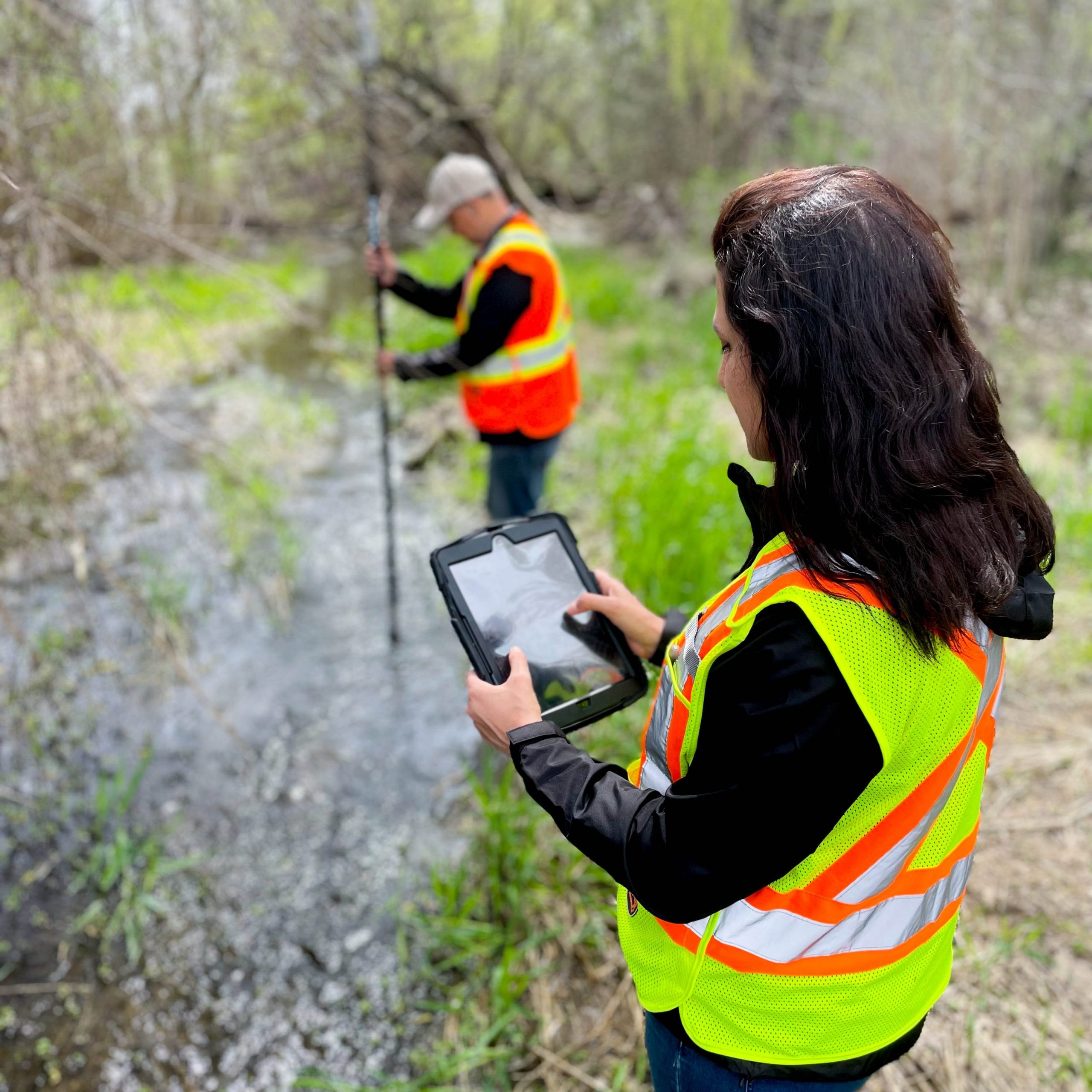
- Environmental monitoring and data collection to assess and report on watershed resource issues, conditions, trends, and risks, including development and management of geographic information system (GIS) to support data management and analysis
- Acquisition of ecologically sensitive lands, wetlands, source areas and valley lands and management of over 11,000 acres owned by Conservation Halton
- Operation of eight active parks for outdoor recreation and education